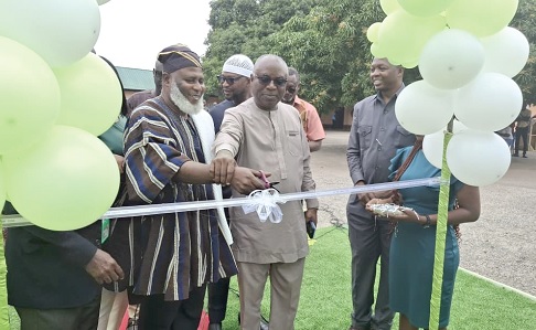
The Lands Commission will, by the end of this year, roll out a nationwide Global Positioning System (GPS) or satellite reference stations at designated areas to improve survey and mapping in the country.
Known as the Continuous Operating Reference System (CORS), this digital infrastructure will serve as a reference station that provides ongoing and permanent real-time positioning information for a specific area to support service delivery.
The commission launched the initiative last Monday, in collaboration with GMX Systems Ghana and the Licensed Surveyors Association of Ghana (LISAG).
Currently, when surveyors conduct surveys, prepare site plans and perform related services, each uses a base station and control points as reference points.
That means that if 1000 surveyors are working simultaneously and not working in groups, they need 1000 base stations.
However, with the new system, 52 CORS will be set up across the country, making it possible for surveyors to do field work without using an individual base station.
Prospects
The acting Director of the Survey and Mapping Division at the Lands Commission, Naa Seidu Zakari Abu, who launched the initiative, explained that the CORS would be operational 24 hours a day, allowing surveyors and others to connect to the system and work at any time. He added that with the new system, work becomes less burdensome because surveyors do not need to carry an extra machine.
Naa Abu stated that the launch of the initiative was a significant milestone in the joint efforts to reinforce the country's spatial data infrastructure.
He stated that accurate spatial data was the foundation of sustainable development as it supports land administration, infrastructure planning, natural resource management, urban development and disaster management.
Zoning, benefits
He added that as part of the strategy to ensure nationwide coverage and operational efficiency, the country had been divided into three zones – southern, northern and middle belt.
The Southern zone comprises the Greater Accra, Volta, Oti, Central, Western and Western North regions; the middle zone covers the Eastern, Ashanti, Bono, Ahafo and Bono East regions; while the Northern, Savanna, Upper East, Upper West and North East regions make up the northern zone.
“This zonal approach will allow systematic observation, efficient data management and full national coverage within a structured framework,” he said.
Naa Zakari Abu said the initiative would ensure accuracy and reliability as surveyors, engineers and spatial data users would have access to high-precision coordinates “24 hours, seven days, in line with the government's 24-hour economy policy.”
LISA support
The President of LISAG, Dr Samuel Larbi Darko, said the CORS was not just a project but a living system that was accessible, accurate and sustainable.
“It is a promise of accuracy, innovation, progress and financial sustainability; and LISAG will continue to work with the Lands Commission and GMX to ensure this vision is not only realised but sustained as the backbone of fieldwork, land administration and national development,” he said.

