Land survey professionals have been called upon to enhance professional competencies to deal with the challenges of land management and spatial planning.
This would help improve the land administration system in the country which is still fraught with many challenges that negatively impact the development and peace in many communities.
The Central Regional Minister, Panyin Edumoah Okyere, made the call in a speech read on his behalf by the acting Regional Coordinating Director, Bless Darkey, at the closing of this year's annual conference and general meeting of the Land Surveying Division of the Ghana Institute of Surveyors (GhIS) in Cape Coast.
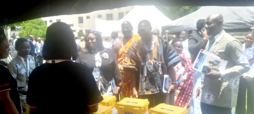
The conference, which was on the theme: "Enhancing land surveyors competencies for sustainable national development", was attended by land surveyors from across the country and a delegation from Cote d'Ivoire.
Adaptability, innovation
Mr Okyere listed some of the challenges as rapid urbanisation, complex land ownership systems, encroachment of public lands and the impact of climate change on land use, stressing that meeting the challenges of land administration required surveyors who were not only technically skilled but also adaptable, innovative and committed to high ethical and professional standards.
He said land surveyors played a crucial role in land administration, and were at the heart of land management, providing critical data for infrastructural development, ensuring that sustainable use of land resources balanced today's needs with the aspirations of future generations.
"Land surveyors are at the heart of national development.
They provide the accurate data and maps that guide physical planning, infrastructure development and land administration. They help to resolve land disputes which continue to be a major source of tension in many communities," he stated.
"As a region and as a country, we cannot have sustainable housing, environmental growth, environmental protection, or agriculture expansion without acknowledging the essential role of land surveyors," he indicated.
Commendation
The regional minister commended the GhIS for its consistency in bringing all related professionals together to promote high professional standards and development.
He encouraged the land surveyors to focus on continuous training, the adoption of modern technologies such as drones and digital mapping systems, as well as stronger collaboration between surveyors, planners and other stakeholders in the built environment to ensure holistic steady growth and development.
"The responsibility of land surveyors in safeguarding the integrity of our land resources is immense.
Let us, therefore, see this conference not only as a platform for knowledge-sharing but also as a call to action, a reminder that the quality of our work today will determine the legacy we leave for the next generation.
He gave the assurance that the government was committed to supporting initiatives that strengthened professional capacity in the land sector.
"Through policies, digitisation of land records and collaboration with professional bodies, we aim to create a transparent, efficient and reliable land administration system that will underpin sustainable development as part of our broad reset agenda,” Mr Okyere stressed.
Policies and collaboration
The Chairman of the Land Surveying Division, Dr Tina Wemegah, said land remained a crucial resource in Ghana, supporting agriculture, housing, transport, energy, and industry and shaping urban growth, driving sustainability and impacting economic development.
She said in recent years, the Land Surveying Division had engaged in discussions on topics pertinent to the evolving technologies within the profession to improve efficiency.
"Building upon that foundation, we are now utilising these advancements to strengthen the competencies of land surveyors, thereby contributing to sustainable national development.
"As land surveyors, we are the custodians of geospatial data, the architects of land demarcation, and the stewards of spatial integrity.
We can no longer just be boundary demarcators and cadastral mappers; we must be strategic enablers of policymaking, sustainable urban planning, disaster risk management, and technological innovation.
"This seminar is, therefore, not just a gathering; it is a call to action.
It is a platform for reflection, innovation, and transformation.
It is our opportunity to reimagine the future of land surveying in Ghana and to equip ourselves with the tools, knowledge, and vision required to lead in a new era," she added.
Dr Wemegah urged members to embrace interdisciplinary knowledge and advanced technological skills to improve professional efficiency.
In a speech read on his behalf, Oguaamanhen, Osabarimba Kwesi Atta II, called for effective collaboration among traditional authorities to reduce land disputes and insecurity in the communities.
An exhibition on new surveying technologies was opened as part of the conference.

