Mapping public health risk
The African Union (AU) passed a resolution at its headquarters in Addis Ababa, Ethiopia, in July 1987, to observe June 30 every year as the Day of Scientific Renaissance of Africa (DSRA).
The move has been to renew interest in the understanding, documentation, and application of science and its related technology to facilitate our social livelihood and economic advancement.
As part of activities commemorating the occasion, the Department of Geography and Resource Development (DGRD) under the College of Humanities, University of Ghana (UG) organised a seminar on the theme: “Geography, the science of space and time”, on June 15, 2022.
It was preceded by the launch at the university-wide level, on June 1, in line with the core mandate of the department to provide exemplary leadership and academic excellence in the development and innovative transfer of knowledge acquired through rigorous scientific investigations.
These are typically in the areas of bio-physical and human environment, population dynamics, climatology, geomorphology, cartography, Remote Sensing and Geographical Information Systems (RS/GIS), community development, agriculture, and various aspects of ecology, community planning, earth science (geology), environmental sanctity, land use, nutrition, and public health.
The climax of the celebration occurred on June 30, with a panel discussion of issues discussed.
GIS
It was most intriguing for me to know through the presentations made, of the existence of Geographic Information System (GIS), a high-tech facility that creates, manages, analyses and maps data, on farmlands, water bodies, drainage systems, wet lands, etc.
This means it connects data to a map, integrating location data with relevant descriptive information. This provides a foundation for mapping and subsequent analysis.
The obvious benefits include improved communication and efficiency, as well as better management and decision-making.
One unique story that public health students will be told often is that of Dr John Scow, one of the founding fathers of modern epidemiology.
During a major cholera epidemic in 1854 in London, he collected and mapped data on the locations (by street addresses) where cholera deaths occurred.
His approach appeared slow and laborious, but, according to the literature, it ultimately led to the identification of the epidemic’s source – a contaminated public water source.
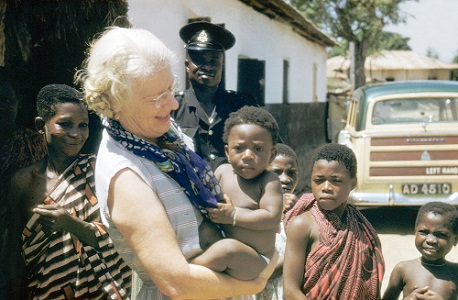
Another interesting example is Dr Cicely Williams, a Jamaican physician, who described the clinical features of “kwashiorkor” in the medical literature, somewhere in 1933.
Her classic writings were based on her close observation of cases reported at the children’s hospital, the Princess Marie Louise, (PML) in Accra.
Through her research, she named the disease “kwashiorkor”, a Ga language coinage depicting the “disease of the deposed child”.
In other words, the disease that Kwashie (male first born) gets when Korkor (female second born) comes too early”; because the attention that Kwashie was receiving from the household will be shifted to Korkor, by virtue of the unfortunate fact that the latter is the “latest arrival”.
It has been corrupted over time to its present pronunciation of “Kwashiorkor”.
Mapping health risk
Epidemiological data and the available analytical geographic methods have enormous utility in public health. We should strive to clarify their relevance and positively project their role in informing decision-making.
Geographical studies (like those in epidemiology and public health) assess the causality of observed associations; estimate their magnitude, uncertainty and any dose–response relationship.
They also ascertain and evaluate whether or not any observed effects apply to individuals and/or populations, and effectively communicate their findings.
The analytical methods for disease mapping, cluster investigation, ecological and environmental analyses, putative risk factor assessment and surveillance activities must be continually evaluated and updated when necessary, with serious collaboration among professionals in the specialised fields of geography, applied statistics, nutrition, medicine, public health, politics and the media.
The writer is a Harvard-trained freelance writer on science and public matters. E-mail:
