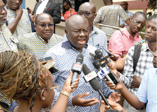
Institution of Surveyors advocates digital map for Ghana
The Ghana Institution of Surveyors has urged the government to support the Lands Commission to develop a comprehensive digital map for Ghana.
It said the last time a modern mapbase was created for the country was in 1974 and it had since become old and outdated due to new developments.
According to the institution, the lack of digital map data was not only affecting geoinformation delivery, but also compelling some public agencies to acquire and process their own data.
It said the situation was frustrating development actors and creating challenges with accuracy and compatibility.
The Vice-President of the institution, Sulemana Dauda Mahama, was speaking at the launch of the 18th Surveyors' Week celebration and the 54th annual general meeting of the institution in Accra yesterday.
He added that although the Lands Commission had initiated moves to develop a digital map for the country, "it lacks the financial muscle to come up with a map that can be used by all actors".
The celebration, which will be on the theme: "Transforming land administration in Ghana: the role of the surveying professional," will end on February 26, 2023.
Significance
Mr Mahama further said that the establishment of a digital map would ensure the development of an integrated land information system and database to facilitate the speedy delivery of secure and credible land titles.
It will also provide the requisite information to bodies such as local assemblies and the Ghana Revenue Authority (GRA) to facilitate revenue collection from property owners.
Mr Mahama also said that apart from the Lands Commission offices in Accra and Kumasi, the other regions did not have the required infrastructure for digital mapping to ensure an efficient and effective land administration system in the country.
He said it was for these reasons that his outfit was pushing for the promulgation of a Surveying Council Bill to improve standards in the sector.
Launch
Launching the week-long activities, the President of the institution, Rosemagaret Esubonteng, said the event was to enable the about 3,000 members congregate and deliberate on issues regarding the profession and the built environment.
Among activities are a young surveyors networking, orientation and induction of newly qualified members and elevation of class of fellows and women in surveying activities.
The conference will begin on Thursday, February 23, 2023, with a presentation of papers and a presidential lecture.
Other activities are a health walk, a medical talk, corporate social responsibility activities, a presidential ball and an inter-religious thanksgiving service.
Responsibilities
The institution, the president said, was a professional body responsible for the training and certification of surveyors in the country and comprised three disciplines - quantity surveying, valuation and estate surveying, and land surveying.
According to her, a good and robust land administration system provided security of tenure, easing of doing business and revenue mobilisation, among other benefits.
“The land administration scene is tremendously weak in its contribution to gross domestic product (GDP). This is critical because revenue from land-related sources in the country amounts to just about 0.03 per cent of the nation's GDP according to a recent World Bank Report," Mrs Essubonteng said.
She said while the EU recorded an average of four per cent GDP, three per cent in USA and two per cent in Japan, other countries such as Gambia, Mauritius and South Africa property rates contributed an average of 0.5 per cent, 1.0 per cent and 1.5 per cent of GDP, respectively.
